Understanding the Importance of Maps in Tokyo
Tokyo, an expansive metropolis with a unique blend of modern marvels and traditional charm, presents a diverse range of experiences for both tourists and residents alike. However, navigating its intricate network of streets and districts can pose significant challenges, making a reliable map essential for anyone seeking to explore the city effectively. A well-structured map acts as a vital tool in overcoming the city’s complexity, ensuring that individuals can orient themselves amidst the bustling urban landscape.


One of the foremost challenges faced by visitors to Tokyo is language barriers. While many signs are now presented in English, the predominance of Japanese can create confusion. A map that includes landmarks, metro stations, and essential points of interest with their names in both English and Japanese can significantly enhance one’s navigation experience. It allows users to communicate directions more effectively, whether asking for assistance or utilizing public transport.
The vast transportation system of Tokyo can also be daunting. With a myriad of train and subway lines, understanding routes and connections requires attention and awareness. A comprehensive map helps in planning efficient travel routes, thereby saving time and avoiding unnecessary transfers. Furthermore, it introduces the possibility of discovering hidden gems – lesser-known neighborhoods, quaint cafes, or scenic parks that lie off the beaten path. Exploring these areas can enrich the travel experience, offering a taste of local culture that might otherwise remain unnoticed.
In summary, the importance of maps in Tokyo cannot be overstated. They not only guide travelers through the city’s complex transportation systems but also provide insights into its intricate layout and myriad attractions. Armed with a good city map, one can navigate Tokyo with confidence, making the most out of every trip.
Top Digital Map Applications for Tokyo
When traveling through the bustling streets of Tokyo, having access to the right digital map applications can significantly enhance your experience. Given the city’s complex layout and extensive public transport system, utilizing effective mapping apps is crucial for navigating its diverse neighborhoods.
Google Maps remains one of the most widely used applications for mapping in Tokyo. Its comprehensive database allows users to explore various locations, obtain real-time transit information, and find nearby attractions and restaurants. The intuitive interface and reliable navigation features make it a top choice for both tourists and locals alike. Users can take advantage of features such as Street View, which provides a virtual tour of the city, making it easier to familiarize themselves with the streets before visiting.
Another excellent option is Citymapper, a highly regarded app specifically designed to ease the complexities of urban transport. Citymapper simplifies route planning by integrating multiple transit options, including trains, buses, and even taxis. The app offers step-by-step navigation, alerts for delays, and options for walking routes. This functionality is particularly beneficial in a sprawling metropolis like Tokyo, where seamless transportation is key to enjoying the city.
For those seeking a more localized experience, NAVITIME is a noteworthy choice. Specializing in the Japanese market, NAVITIME provides extensive train schedules, route recommendations based on current traffic conditions, and even a feature that allows users to search for stations based on the type of amenities available. Its user-friendly interface caters to both Japanese speakers and international travelers, making it accessible to a wider audience.
While each of these apps offers unique benefits, travelers should also be aware of potential drawbacks, such as the reliance on mobile data or the occasional inaccuracies in real-time updates. However, with a combination of these tools, navigating Tokyo becomes a more manageable and enjoyable undertaking.
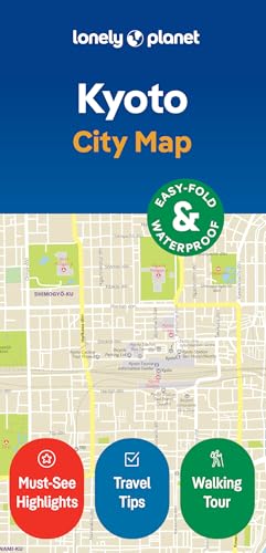
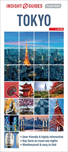
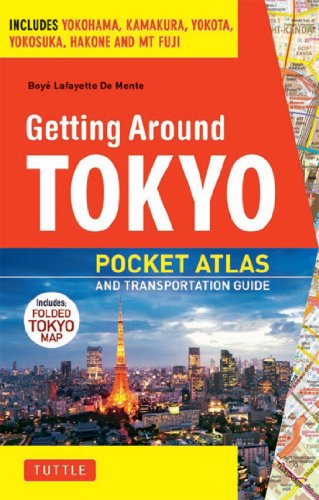
Best Traditional Paper Maps for Tokyo Exploration
In an age dominated by digital navigation, traditional paper maps still hold significant value, particularly when exploring a vibrant city like Tokyo. These maps not only provide a tangible experience but also offer unique benefits that digital formats may lack. For instance, traditional paper maps encourage a more engaged exploration of the city, allowing travelers to observe their surroundings and make spontaneous decisions about where to go next.
One of the most commendable traditional paper maps for Tokyo is the “Tokyo City Atlas” by Shobunsha. Renowned for its accuracy and comprehensive detail, this map covers all major districts, streets, and even smaller alleys, making it an indispensable tool for any traveler aiming to navigate the city’s complexities. The map also includes points of interest such as historical sites, parks, and neighborhoods, allowing users to plan their journeys with ease.
Another highly regarded option is the “Tama Art University Tokyo City Map,” which not only guides users through the bustling metropolis but also presents an aesthetic appeal, featuring artwork and design that reflect the city’s culture. This map is perfect for those who appreciate not only functionality but also the illustrated beauty of Tokyo.
When seeking these traditional paper maps, visitors are advised to stop by local tourist information centers, which often stock a variety of maps tailored to different interests. Additionally, numerous bookstores throughout Tokyo, especially those in areas frequented by tourists, carry quality maps, including detailed bilingual versions that can facilitate easier navigation.
While smartphones and GPS devices provide convenience, the tactile experience and reliability of traditional paper maps make them an essential resource for anyone wishing to explore the intricacies of Tokyo. Travelers can benefit greatly from utilizing these physical maps during their journey, ensuring they do not miss out on the countless wonders that the city has to offer.
Tips for Using Maps Effectively in Tokyo
When navigating the vibrant streets of Tokyo, having an effective map can significantly enhance your travel experience. Start by familiarizing yourself with major local landmarks, as they serve as excellent reference points when orienting yourself. Iconic sites such as the Tokyo Tower, Shibuya Crossing, and Senso-ji Temple not only enrich your sightseeing but also help anchor your navigation. Understanding these prominent locations assists in better comprehending the map layout and aids in planning your routes.
Another essential tip is to learn basic navigation terms in Japanese, such as “kita” (北 meaning north), “minami” (南 meaning south), “nishi” (西 meaning west), and “higashi” (東 meaning east). Familiarizing yourself with these terms can make a noticeable difference in communicating with locals and understanding directional signs. Additionally, local station names and certain key attractions are often presented in both English and Japanese, ensuring that even non-speakers can navigate effectively.
Utilizing both digital and paper maps can also enhance your navigation capabilities. Digital maps, such as Google Maps, are updated in real-time and can provide live directions, which is beneficial when exploring Tokyo’s complex transport system. However, offline paper maps have their advantages, particularly in areas with limited internet connectivity. Carrying a pocket-sized map as a backup can be incredibly useful. When faced with a challenging route, refer to both formats to cross-verify directions, which ensures a smoother journey.
In real-life scenarios, you might find yourself at a bustling train station where announcements could be overwhelming. In such cases, quickly checking a paper map for nearby exits or transferring lines can be far more effective. Overall, these strategies will empower you to maximize your time in Tokyo and navigate the city like a local.